
Suburban
An urban–rural transition area around Bolton, with rooftops, asphalt roads, swimming pools, ponds, grassland, shrubs and urban forest. Reference classes: asphalt, rooftop, shadow and vegetation.

Research Products / Open dataset
Three 301-channel hyperspectral images of suburban, urban and forest landscapes in southern Ontario, with reference polygons for classification.
The University of Toronto Hyperspectral-301 (UT-HSI-301) dataset consists of three hyperspectral images with 301 spectral channels, covering suburban, urban and forest landscapes in southern Ontario. The images were collected and pre-processed by the RSSEM Lab.
The dataset was used to study how spectral dimensionality reduction affects hyperspectral pixel classification: five methods (PCA, KPCA, ICA, autoencoders and denoising autoencoders) compressed the 301-dimensional pixels before classification. It is hosted by the Visual Computing Lab at Ontario Tech University.
This dataset can serve as an open benchmark for hyperspectral image analysis. With 301 spectral channels and reference polygons for suburban, urban and forest scenes, it can be used to develop and compare dimensionality reduction and classification methods, including machine learning and deep learning models, for mapping rooftops, roads, lawns and trees, as well as to design efficient processing pipelines for settings with limited computing resources.
An urban–rural transition area around Bolton, with rooftops, asphalt roads, swimming pools, ponds, grassland, shrubs and urban forest. Reference classes: asphalt, rooftop, shadow and vegetation.
A residential area around Bolton with rooftops, houses under construction, roads and lawns. Reference classes: asphalt, lawn, rooftop and shadow.
A natural forest at a University of Toronto biological site in the King City area. Reference classes: shadow (17 polygons) and tree (15 polygons).
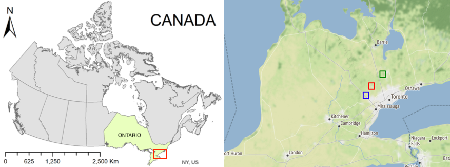
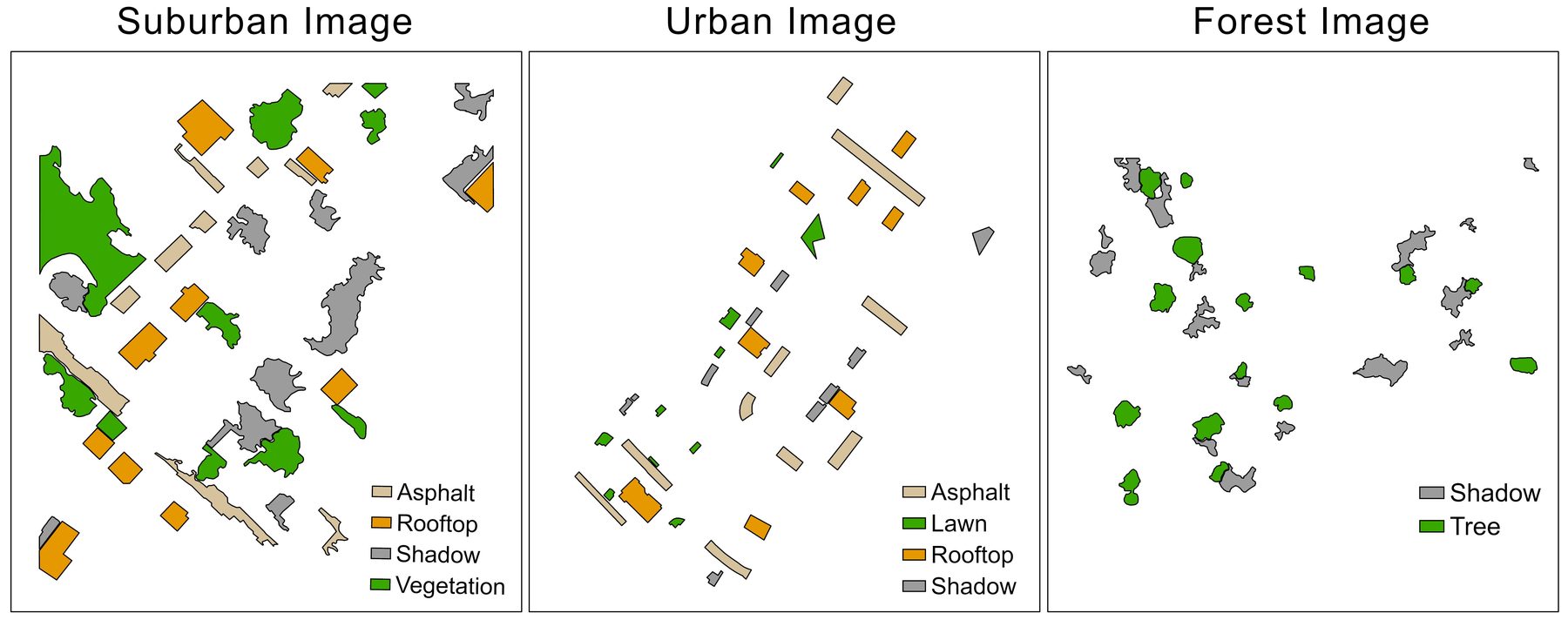
Figures: UT-HSI-301 dataset page, Visual Computing Lab, Ontario Tech University (CC BY 4.0).
Mantripragada, K., Dao, P. D., He, Y., & Qureshi, F. Z. (2022). The effects of spectral dimensionality reduction on hyperspectral pixel classification: A case study. PLOS ONE, 17(7), e0269174. https://doi.org/10.1371/journal.pone.0269174
Please cite this article when using the dataset.
Questions about the imagery, its acquisition and pre-processing, or collaboration on hyperspectral analysis are welcome. Please get in touch with the laboratory.
For other enquiries, see the lab contact page.
Principal Investigator, RSSEM Lab
Department of Geography, Geomatics and Environment, University of Toronto Mississauga