
Pre-fire vegetation
The most important variable: pixels with more vegetation before the fire burned more severely. Barren land and coniferous forest were linked to higher severity, broadleaf forest to lower.
Research Products / Open dataset
Open data, a trained XGBoost model and code from a 35-year analysis of the climate, vegetation and topographic drivers of wildfire severity in the central Yukon, Canada.
Subarctic ecosystems are experiencing earlier, longer and more intense wildfire seasons, and large fires damage the environment, release stored carbon and force residents to relocate. This product supports a study of what drives wildfire severity in the Klondike Plateau and Yukon Plateau-Central ecoregions of the Yukon, Canada, based on the 70 fires larger than 50 km² recorded between 1986 and 2020.
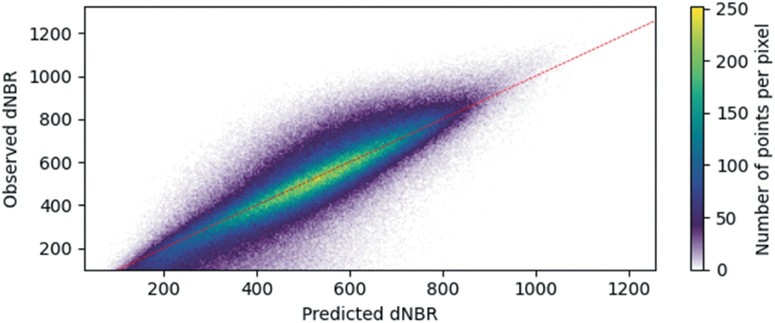
Burn severity measured from Landsat imagery was combined with climate, topographic and forest land cover data at a common 30 m resolution, and an XGBoost regression model, interpreted with SHAP (Shapley Additive Explanations) values, was trained on the selected variables. The model reached a validation pseudo r² of 0.70.
This product can support the study and management of wildfire in subarctic Canada, where remote locations and sparse populations make forest management difficult. The data, model and code can be used to examine how pre-fire vegetation, surface dryness, wind and terrain combine to drive severe burning and to inform practices that reduce the habitat loss and carbon release caused by severe fires, as well as to provide a basis for similar studies in other subarctic regions.
The most important variable: pixels with more vegetation before the fire burned more severely. Barren land and coniferous forest were linked to higher severity, broadleaf forest to lower.
Skin reservoir content, evaporation from vegetation transpiration and soil temperature ranked second to fourth. Less canopy water, more evaporation, warmer soil and higher wind speed pointed to higher severity.
Ridges and hills with more visible sky and higher wind exposure burned more severely than flat land, valleys and gullies.
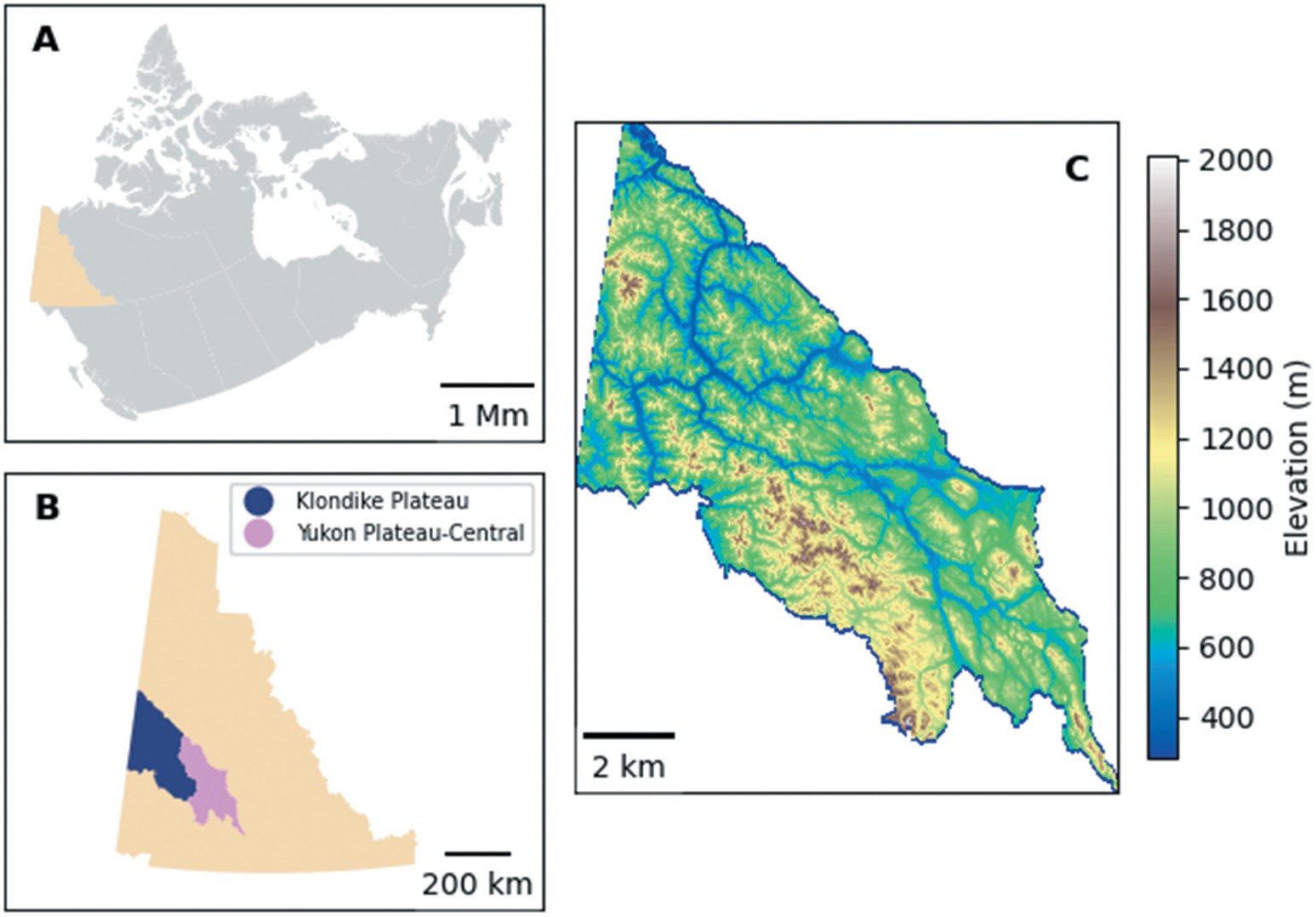
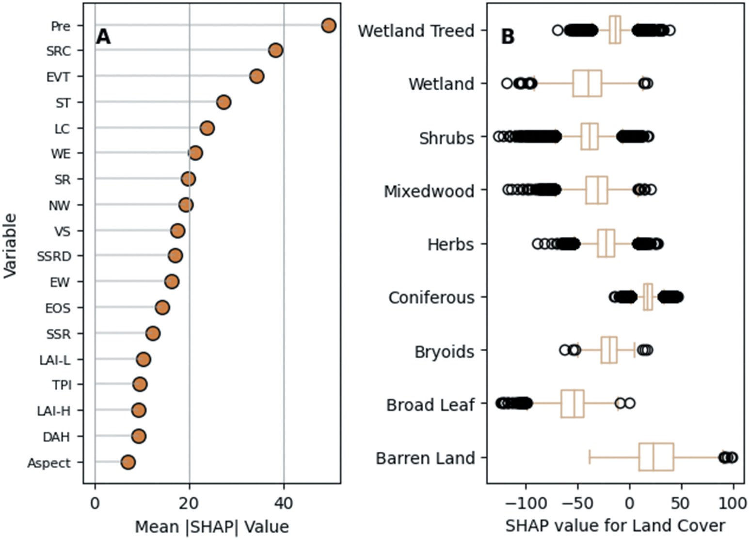
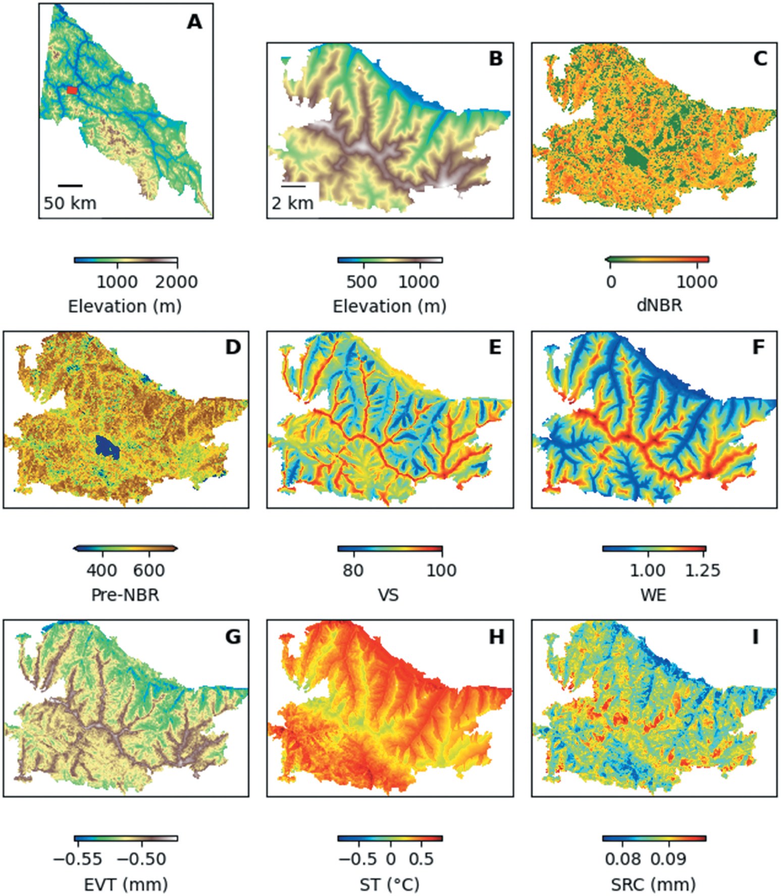
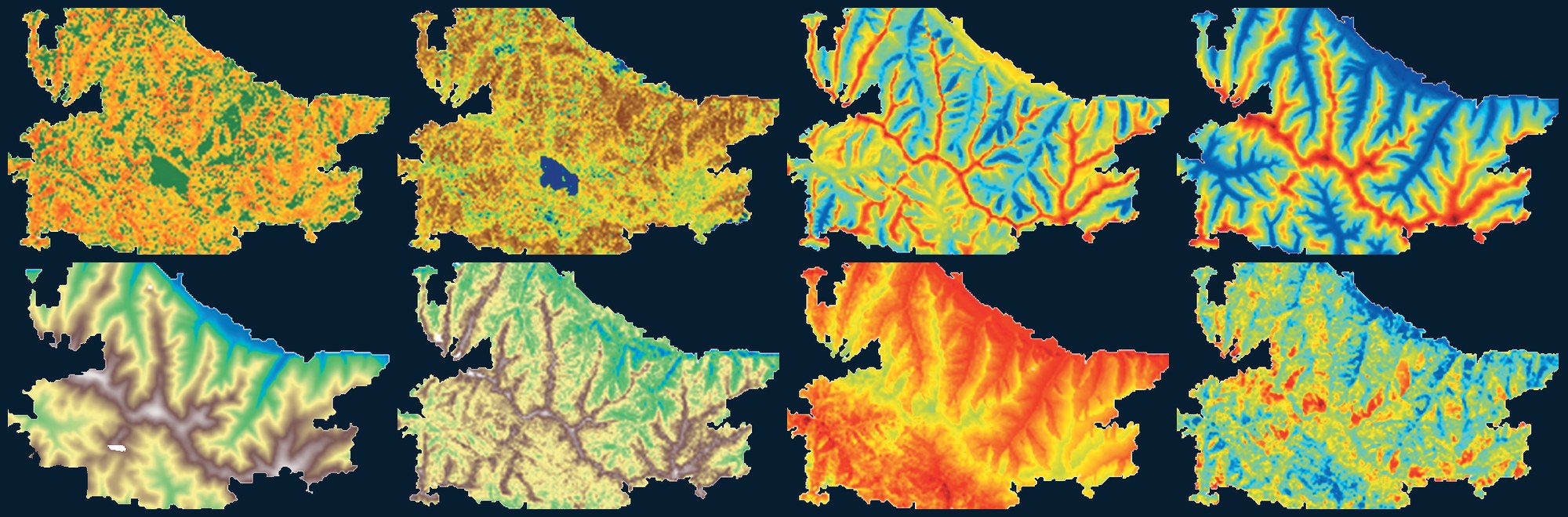
Figures from Nelson, D. M., He, Y., & Moore, G. W. K. (2026), Big Earth Data, © 2025 The Author(s), published under a CC BY 4.0 licence. The banner image is adapted from panels B–I of Figure 6 (cropped, rearranged, panel labels removed and the white background recoloured).
Nelson, D. M., He, Y., & Moore, G. W. K. (2026). Driver analysis of subarctic wildfire severity over a 35-year period. Big Earth Data, 10(1), 319–345. https://doi.org/10.1080/20964471.2025.2558408
Nelson, D., He, Y., & Moore, G. W. K. (2025). Data and Model Supplement: Driver Analysis of Subarctic Wildfire Severity over a 35-year Period (Version 1.0.0) [Data set]. Zenodo. https://doi.org/10.5281/zenodo.15446613
Nelson, D., He, Y., & Moore, G. W. K. (2025). Code Supplement: Driver Analysis of Subarctic Wildfire Severity over a 35-year Period (v1.0.0) [Software]. Zenodo. https://doi.org/10.5281/zenodo.15485182
Please cite the article when using the data, model or code.
Questions about the data, the model or collaboration on wildfire research are welcome. Please get in touch with the laboratory.
For other enquiries, see the lab contact page.
Principal Investigator, RSSEM Lab
Department of Geography, Geomatics and Environment, University of Toronto Mississauga