
Side-by-side comparison
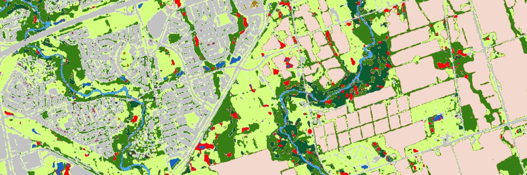
The 2020 and 2025 maps sit next to each other, each with its own legend and overall accuracy, for direct visual comparison.
Research Products / Interactive web app
Land use and land cover of the Toronto and Region Conservation Authority jurisdiction, mapped from 3 m PlanetScope imagery with deep learning for 2020 and 2025.
This Google Earth Engine application presents land use and land cover (LULC) maps of the jurisdiction of the Toronto and Region Conservation Authority (TRCA). The maps were produced from 3 m PlanetScope satellite imagery using deep learning, and classify the landscape into ten classes, from agriculture and two forest types to wetlands, rivers and urban land.
Two map panels show the 2020 and 2025 classifications side by side, so that change across the region can be compared directly, and a training-sample browser shows the samples the classifier was trained on.
These LULC products can support watershed management and environmental planning across the TRCA jurisdiction. The 3 m maps can be used to assess urban growth, stormwater runoff and flood risk, road-salt transport, habitat and wetland loss, forest change, water-quality impacts, and agricultural land conversion, as well as to identify priority areas for restoration, green infrastructure, flood mitigation, and long-term watershed monitoring.
The 2020 and 2025 maps sit next to each other, each with its own legend and overall accuracy, for direct visual comparison.
Agriculture, barren land, deciduous and coniferous forest, grass/shrub, wetland, urban, water body, river and others.
Every training sample can be viewed together with its PlanetScope imagery and the resulting classification.
The application has two zoomable maps with layer controls and a training-sample panel. It is also available full screen.
Colours match the legend in the app.
RSSEM Lab. TRCA Jurisdiction Mapping using 3 m PlanetScope Imagery and Deep Learning [Google Earth Engine application]. Remote Sensing and Spatial Ecosystem Modeling Laboratory, University of Toronto Mississauga. https://ee-ydzhang1128.projects.earthengine.app/view/trcalulc
Suggested citation for the application. To use the maps in research, planning or teaching, or to ask about the underlying data, please contact the lab.
Questions about the maps, requests for data or ideas for collaboration are welcome. Please get in touch with the laboratory.
For other enquiries, see the lab contact page.
Principal Investigator, RSSEM Lab
Department of Geography, Geomatics and Environment, University of Toronto Mississauga